
Web SEDA (EN)
![]()
SEDA: SATELLITE DATA AI
The SEDA project is based on the 2018 call of the COINCIDENTE programme for the creation of "Intelligent systems for the analysis and exploitation of information applied to the resolution of military problems". SEDA intends to carry out the definition, development and implementation of a geospatial intelligence web platform for Defense.
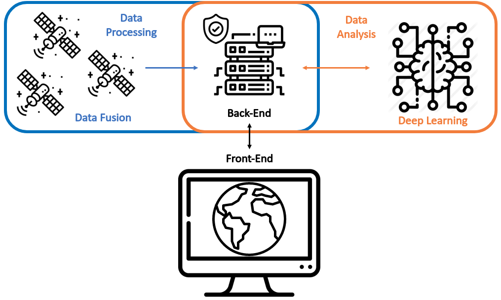
Given the exponential increase in the number of satellites and their derived data, it is essential to have a tool to manage such information to be useful. The potential of Artificial Intelligence (AI) is combined here with data processing and advances in the field of Data Fusion for the automatic analysis of satellite information.
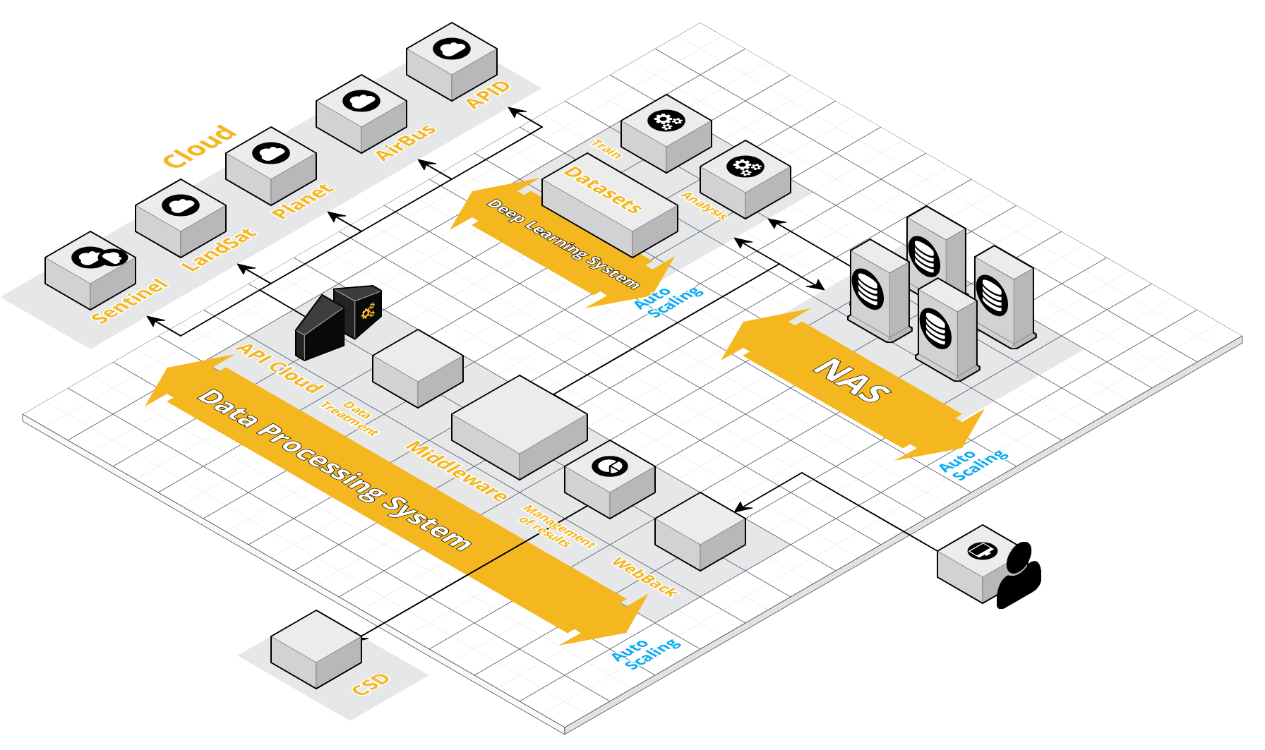
This platform will be based on a set of AI engines that will allow, on the one hand, the collection, fusion and analysis of satellite data (mainly radar images) from private channels and open sources and, on the other hand, the automatic detection in the images (Remote Sensing) derived from them, of "anomalies" or objects whose identification is key when making decisions that may compromise security both at national and international level.
No Comments